One of the most frequent questions new land buyers have is whether or not they should get a survey of their land purchase. Having peace of mind knowing that your boundaries in good shape is a big deal for most buyers. There are a few factors to consider when thinking about having a survey done.

Cost
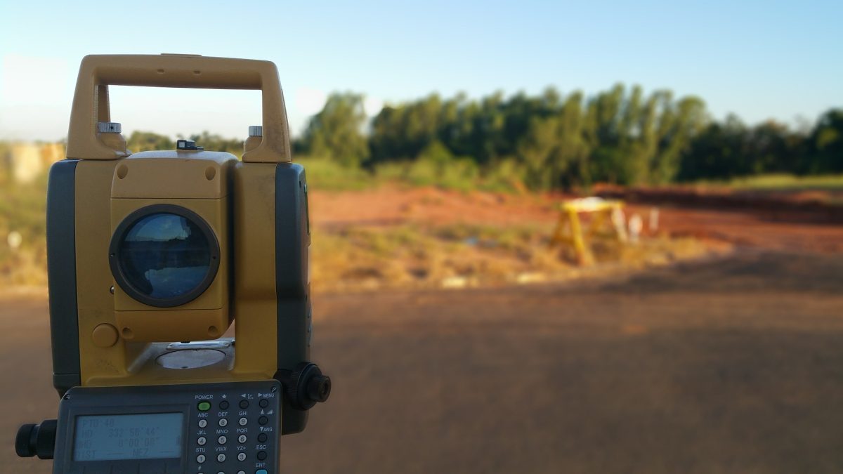
The most important factor for buyers is going to be the cost of a survey, and if the cost of having the survey completed outweighs the savings of not doing it at all. A full survey on 100 acres of land in West Virginia could cost anywhere from $5,000 to $10,000 depending on the topography, deed descriptions (the good, the bad and the ugly) for the property and adjoining landowners, ease of field work, and the schedule and rates of the surveyor to name a few. Properties with topographic calls that run with the ridge, or a creek, are easier to determine than those with specific metes and bounds that may vary with adjoining deeds and generations of transcription from one deed to another. Field work that can be completed on open, rolling terrain will take less hours than steeps hollows and gullies are much harder to traverse. A surveyor that has a booked schedule may need to charge more for a project to move you into their field docket. If the price tag of a full survey of your property is causing you to second guess your plans, consider a few other things before deciding.
Tax Map Boundaries
Boundaries that are generated from Property Viewer websites or GIS mapping applications are never going to be exact. Some aren’t even close. Boundaries found online are used for property taxes and general identification purposed to get a rough estimate of what actual boundaries may be for tax assessment purposes. Tax map boundaries can be very helpful though if you know what to look for. A map will have two different acreage values: Deeded Acres, and Calculated Acres. Deeded acres describe what the total acreage of the tract is referred to in the deed description. Calculated acres describe the GIS scaled acres showing up in the map on the computer. If boundaries on the tax map do not run with the exact metes and bounds described in the deed (which they won’t in most cases), then the Deed Acres and Calculated Acres will not match. If there is a large difference in the two values, then that may be a sign that a survey would be beneficial. If these values are very similar, then the tax map boundaries usually stand a better chance of being more representative of actual boundaries.
Topographic Calls and Metes and Bounds Survey System
Property boundaries in West Virginia are not laid on a metes and bounds system not the public lands survey system (PLSS) that uses square grids. The hills and hollows run throughout the entire state, and gridded property boundaries did not make sense logistically for ownership. When looking at a deed and tax maps, look for boundaries that run with the ridges or high points on hiss and mountains, or run along a creek or drain. With these types of boundaries, you can reasonably assume and visualize where your property line is. If the tax map shows this as well, then it may not justify the need for a survey. For property lines that do not follow topographic features, visualizing the boundary can be more difficult. These are described by a set of points/markers, directions, and distances that can be confusing if you are not used to reading deed descriptions.
Adjoining Landowners
Your neighbor for your new property can be your best friend, or your worst enemy in some cases. The best thing for a new landowner to do is try to build a relationship with their new neighbors to get off on the right foot. One way to determine the boundaries of your property can be to ask the neighbor their knowledge of where corners and property lines are. In metes and bounds surveys monuments on the land often prevail so such markers as hacked trees, “x” on rocks, metal pins, old barbed wire fence line and even where timber was last cut can dictate lines and corners. Since the neighbor would be the one you would have a boundary dispute with in the future, knowing where they believe the boundary is can be helpful in your decision making process of getting a survey. They may know where corner pins are, or where some old fence line is running. If their opinion of the boundary matches the maps you have and the picture you have in your head, then you are helping to prevent any future disputes when you harvest timber, run fence, or develop the land. If your neighbor sits further back into your property than what is shown, you may want to get a survey to have a clearer picture of the boundaries if there are further disputes. Even at that a good discussion with the neighbor in regard to any discrepancies and before surveying is a good “friendly neighbor” idea.
To add a little more mud to milky waters, a lot of folks think that a surveyors map and property description is set in stone once it’s done and delivered to the owner. Well, turns out its not. That survey map and description by law is only that surveyor’s professional opinion. Your neighbor, that you didn’t develop the best relationship with just hired his own surveyor that came back with a different opinion and it turns out its more favorable to your neighbor. So where do you go from there. Court usually. Fortunately this doesn’t happen often but it can.
Surveyor Availability
The availability and schedule of licensed surveyors in your area can vary depending on supply and demand, size of contracts, and location. A lack of surveyors in a buyer’s market will mean there will be packed field dockets and long waits for you to get a finished product. Moving your project up will cost more money and may not be an option. Surveying companies that have large contracts on the schedule may not be as willing to place a smaller land survey that will earn them less money. A surveyor that must travel longer distances will also charge more for their work. If you are buying land in a new area, having an experienced Land Agent that has the relationships and knowledge of surveyors in the area will be helpful to make the process as painful as possible. Long waits and billable hours can add up, delaying the closing date of your property, and costing you more money.
Pre-Survey Services
We offer services here that assist landowners and land buyers with boundary line questions and issues. We call them pre-survey services and they include computer mapping of deed calls, GIS mapping, GPS locations of field monuments and a summary report that describes the findings. Owners and buyers can then take this report to their surveyor to show them exactly what has been found and what survey services are needed. Surveying on only an unknown portion is much less costly than surveying 100% of a boundary that 80% of the lines and corners are well established and totally agreed between you and your neighbors.
Boundary Care
If you are fortunate and your new land purchase boundaries check out 100% to your satisfaction, mark your boundaries as soon as possible. This can be done in multiple ways. We recommend setting metal T posts at your corners. You can always find these. Paint your boundary lines with the paint facing the neighbor’s property. Use purple paint and it will double as a legal no trespassing marker by West Virginia law. Use posted signs if you wish and put your name and a contact on the sign. Use durable tree marking paint that will last for 6-10 years, not off the shelf spray paint from Lowes.
Conclusion
Having a survey completed on your property isn’t as simple as finding an estimate online and deciding you want to have one completed. Good due diligence during your land search, and an understanding of the surveying market in your desired area makes a complicated decision easier to make. If after researching your property you decide to hire a surveyor, reach out for quotes and schedules to see if it makes sense economically. If you can solve the issues that come with boundary disputes without having to buy a survey, you can save some money and headache. If you need to have one done, working with a qualified Land Agent and getting pre-survey analytics can make the experience smoother.


